Disabled
Allendale Golf Club Dark Sky Discovery Site
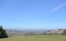
Allendale Golf Club has been recognised as a great place for amateur and professional astronomers to stargaze. With wide open views of the horizon and a location away from the light pollution of towns and cities, the skies are incredibly dark. Under a clear night sky, the major constellations can be seen and the Milky Way is also visible to the naked eye. During organised stargazing events the club room is the perfect place to get warm and discuss the latest astronomical news and sightings. The facilities here are suitable for disabled visitors and there is good access to the viewing area from the car park. For more information on events, visit www.northpennines.org.uk. The golf course is popular due to its remote and quiet location and stunning views over the East Allen Valley, as well as some interesting and challenging holes - www.allendale-golf.co.uk
Location:
Located just off the B6295, approximately 1.5 miles south of Allendale Town.
Area:
Access:
Facilities nearby
Recreation opportunities:
Interests:
Link:
Allendale Market Place Visitor Information Point
Allendale is a perfect stopping point for a journey around the North Pennines. Pop in to the visitor information point in Allendale Market Place to discover places to visit, eat and stay.
From the Market Place you can set out on foot along the river or head up to on to the fells for panoramic views.
Location:
The Information Point can be found in Allendale Post Office
Area:
Access:
Facilities nearby
Recreation opportunities:
Ark on the Edge - Animal Rescue Centre, Teesdale
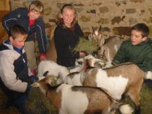
Ark on the edge is an animal rescue centre and sanctuary and has a fully equipped wildlife education centre and a mile-long nature trail. The centre offers courses in animal care and group visits are welcome. It is open to the public to visit, see the animals, walk the nature trail, or you can do a spot of pond dipping. Ark on the Edge welcomes disabled visitors, call for details (01833 630505).
Location:
Woolley Hill Farm, Woodland, Co. Durham, DL13 5RX (NZ044249)
Distance:
2 km
Terrain:
Off road sections, On road sections
Area:
Access:
Facilities nearby
Recreation opportunities:
Interests:
Link:
Beamish Museum

Beamish Museum is a living and working open air museum that shows what life was like in the Geordian, Edwardian and Victorian eras. Beamish stands in 300 acres of beautiful County Durham countryside. Within our site you will find Pockerley Old Hall, The Town, Rowley Station, The Fairground, Home Farm and The Pit Village. With so many things to see, Beamish is a wonderful day out for people of all ages.
Location:
Beamish Museum, Beamish, County Durham, DH9 0RG.
Access:
Facilities nearby
Recreation opportunities:
Link:
Bowlees Picnic Area
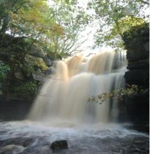
Bowlees picnic area is found is located in a beautiful part of Upper Teesdale. There are four small waterfalls and a riverside footpath leading to Summerhill Force and Gibson’s Cave; Gibson was a 16th century outlaw who lived behind the waterfall to stay hidden from the law. There are plenty of places to sit in quiet contemplation surrounded by the sound of cascading water. Look for the white breast of the dipper bobbing in and out of the water searching for food or the buzzard soaring above your head. The old limestone quarry contains many limestone-loving wildflowers, including seven species of orchids, knapweed and wild thyme. These plants attract butterflies and other insects, which are prey for magnificent dragonflies.
Location:
The picnic area is located in the car park behind Bowlees Visitor Centre off the B 6277.
Terrain:
Off road sections, Steep sections
Area:
Access:
Facilities nearby
Recreation opportunities:
Download:
Bowlees Visitor Centre
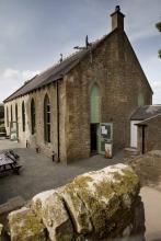
Bowlees Visitor Centre, run by the North Pennines AONB Partnership, is a fantastic base for exploring Upper Teesdale, with footpath links to Low Force, High Force, Newbiggin and the Pennine Way. The Centre provides information and displays on the geology and landscape, wildlife and people of Upper Teesdale and the wider North Pennines. You'll find a delicious range of food and drinks and our shop stocks nature inspired gifts and books. You'll find a range of special events are running at the Centre throughout the year. You can also hire the venue for family get-togethers, parties and meetings. We have a range of outdoor cooking facilities which can be pre-booked. The Centre is dog-friendly and you'll find free Wi-Fi access, an iGlass (24-hour information touch screen) and an electric car-charging point. Follow the Richard Watson Trail from the Centre - a 2¾-mile circular route exploring the life and times of Richard Watson, Victorian lead miner and poet. The most popular walk is probably the High Force-Low Force Round. The Centre is also an official Dark Sky Discovery Site.
Location:
Newbiggin, Bowlees, Middleton-in-Teesdale, Co. Durham, DL12 0XE (grid ref - NY906281). 01833 622145.
Area:
Access:
Facilities nearby
Recreation opportunities:
Interests:
Link:
Bowlees Visitor Centre Dark Sky Discovery Site

Designated as a Dark Sky Discovery Site, Bowlees Visitor Centre has been recognised for the quality of its dark night skies. This is a great place for professional and amateur astronomers to stargaze.
Location:
Newbiggin, Bowlees, Middleton-in-Teesdale, Co. Durham, DL12 0XF. 01833 622145.
Area:
Access:
Facilities nearby
Recreation opportunities:
Link:
Burnhope Reservoir Dark Sky Discovery Site
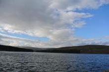
Designated as a Dark Sky Discovery Site, Burnhope Reservoir has been recognised for the quality of the night time skies. This is a great place for professional and amateur astronomers to stargaze in the North Pennines AONB. Burnhope Reservoir is one of the smaller reservoirs in the area. It's found in Upper Weardale just west of Ireshopeburn. This is a quiet spot and great for wildlife. Permissive paths around the reservoir edge pass though plantations and woods with fantastic views across moorlands.
Location:
Follow the A689 westwards up Weardale. Take the second left hand turn in Ireshopeburn. After a mile, turn right down a gated lane
Area:
Access:
Recreation opportunities:
Interests:
Link:
Derwent Reservoir
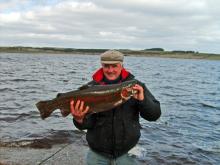
Derwent Reservoir is Northumbrian Waters most popular fishery, with anglers liking the combination of lots of bank space and the chance to catch specimen trout weighing up to 20 lbs. Throughout the season a number of tagged fish will be stocked with special prizes awarded to those anglers lucky enough to catch them. In addition, there is a designated pegged area for coarse anglers who can expect to catch some quality roach. Derwent is suitable for disabled anglers and visitors. On site they have an excellent shop stocked with everything you need for a day's fishing including rods, reels, tackle, accessories, clothing, worms, bait, ice creams and refreshments including cold drinks. Environment Agency rod licences are also on sale at this fishery. For those not fishing, there are several picnicking and play areas, plus spectacular walks along the north and south shores and across the dam. A wheelchair accessible trail runs from the south end of the dam along to Pow Hill Country Park and from the north shore of the dam wall to Millshield picnic site. Permits can be purchased online through the Fishpal website (www.fishpal.com/NorthumbrianWater).
Location:
Located just off the A68 and four miles west of Castleside, turn south at the Manor House pub and follow the road into the valley
Terrain:
Off road sections, On road sections
Access:
Facilities nearby
Recreation opportunities:
Download:
Derwent Reservoir - Walks, rides and wildlife
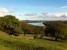
Derwent Reservoir is within the North Pennines AONB and, after Kielder, is the second largest reservoir in the region. There is a multi-user path from Pow Hill Country Park (south shore) to the dam at the eastern end of the reservoir and then round the north shore to Millshield Picnic Area. You can find out more about the reservoir, its wildlife and its history as you go, on foot or by bike. Cyclists can make a longer circular route around the reservoir by combining the shore path with local roads.
Location:
Derwent Reservoir is in the north-eastern part of the North Pennines AONB, between Blanchland and Edmundbyers - the south shore is in County Durham and the north shore is in Northumberland. Start from Pow Hill Country Park (NZ011517 / DH8 9NU - nearest) or Millshield Picnic Area (NZ013532 / DH8 9PT - nearest).
Distance:
3 km
Access:
Recreation opportunities:
Interests:
Link:
Derwent Reservoir and Pow Hill Country Park

Welcome to Derwent Reservoir and Pow Hill Country Park! This leaflet is one of a number of ways in which you can find out about the wildlife and history of Derwent Reservoir and Pow Hill Country Park. The heathland around the reservoir is a haven for reptiles like Adders, Slow Worms and Common Lizards. The reservoir is also important to many species of birds which use it as a migratory stop over and breeding site.
Location:
Routes starting from either Derwent Reservoir car park or Pow Hill Country Park car park.
Distance:
2 km
Terrain:
Off road sections
Access:
Facilities nearby
Recreation opportunities:
Interests:
Derwent Reservoir: North Pennine Birdwalks - Site 1
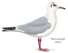
Derwent Reservoir can be an interesting place to watch birds at any time of year. Wildfowl such as greylag goose, mallard, teal and tufted duck may be seen year-round, their numbers being swelled during autumn and winter by wigeon, pochard and goldeneye. Large flocks of gulls also congregate on the reservoir during the winter, most notably black headed, common and herring gull. Other species of interest include grey heron, goosander, cormorant and great crested grebe.
Location:
Multiple viewing points around the reservoir.
Terrain:
Off road sections, On road sections
Access:
Facilities nearby
Recreation opportunities:
Interests:
Link:
Grassholme Reservoir
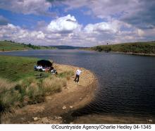
Grassholme is firmly established as one of the top any method fisheries in the country, lying in the picturesque rolling pasture land of upper Teesdale. With four miles of bank space and many inlets and bays it offers a great variety of fishing. Grassholme also enjoys the luxury of its own local fish farm. Grassholme is suitable for disabled anglers and visitors. On site Northumbrian Water have provided an excellent lodge shop stocked with everything you need for a day’s fishing including rods, reels, tackle, accessories, clothing, worms, bait, ice creams and refreshments including hot and cold drinks. Environment Agency rod licences are also on sale at the fishery. There is a circular footpath around the lake providing magnificent views across the water and a pleasant picnicking area next to the visitor centre for you to relax at.
Location:
Take the B6277 from Barnard Castle towards Mickleton. Turn off at the western end of the village, sign posted Grassholme Reservoir. The trout fishery is roughly a mile up the road on the right
Terrain:
Off road sections, On road sections
Area:
Access:
Facilities nearby
Recreation opportunities:
Download:
Grassholme Reservoir Dark Sky Discovery Site
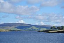
Designated as a Dark Sky Discovery Site, Grassholme Reservoir has been recognised for the stunning quality of its night skies. This is a great place for professional and amateur astronomers to stargaze in the North Pennines AONB. Access to the reservoir for stargazing is only available during organised events (see www.northpennines.org.uk for details). Grassholme is also firmly established as one of the top 'any method fisheries' in the country.
Location:
Take the B6277 from Barnard Castle towards Mickleton. Turn off at the western end of the village, signposted Grassholme Reservoir. The main car park is roughly a mile up the road on the right.
Area:
Access:
Recreation opportunities:
Interests:
Link:
Hamsterley Forest
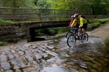
County Durham's largest forest is a mixture of woodland, meadows and forest. There are excellent walking, cycling and horse riding trails for all abilities. The forest also has a childrens' adventure playground, tea room, cycle hire, shop and downhill mountain bike course.
Location:
Hamsterley Forest (NZ091312 / DL13 3QH).
Terrain:
Boggy ground, Off road sections, On road sections, Steep sections
Area:
Access:
Facilities nearby
Recreation opportunities:
Interests:
Link:
High Force and Bowlees Geotrail
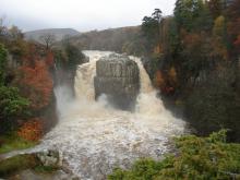
This 8km circular walk, from Bowlees Visitor Centre or High Force car park, will introduce you to some of the special features of the landscape around High Force and Low Force waterfalls. You'll discover rocks with dramatic origins, ice age features, ancient settlements, lead mining heritage and wonderful wildlife.
Location:
Circular walk which can be started from Bowlees Visitor Centre (NY906282 / DL12 0XE) or High Force car park (NY885286 / DL12 0XH) in Upper Teesdale.
Distance:
8 km
Terrain:
Off road sections, Steep sections
Area:
Access:
Facilities nearby
Recreation opportunities:
Interests:
Link:
Download:
Download GPX file:
High House Chapel
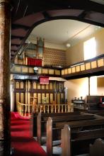
Historic Methodist Chapel - High House Chapel, Ireshopeburn, is the oldest purpose built Methodist chapel in the world to have been in continuous weekly use since it was built in 1760. Writing in his book England’s Thousand Best Churches Simon Jenkins said “This is the country where the fires of Methodism took hold, fanned by an absentee Anglicanism. There are many chapels in these parts, many are early and handsome and Ireshopeburn is the best.” His chapel and society in Weardale became one of John Wesley’s favourites and the story of Methodism is well told in the folk museum next door. The chapel is open to the public during museum hours 2-5pm, Wed-Sunday, May 1st - October 31st and every afternoon in August. Also Easter and bank holidays. Services are held every Sunday at 10.45am
Location:
Ireshopeburn, Co. Durham, DL131HD.
Area:
Access:
Facilities nearby
Recreation opportunities:
Interests:
Hury Reservoir
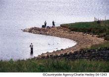
Hury is exclusively a fly fishery and is the ideal venue for traditional fly anglers who like to fish with wet and dry flies as well as lures. Stocked weekly, often with grown on fish from our Teesdale fish farm, Hury is a must for traditional fly fishing enthusiasts. For non-anglers, there is a circular walk around Hury. There is a picnic and play area on the south shore next to the dam wall for you to relax at. Hury is suitable for disabled anglers. Please note, from Wednesday 5 September 2012, day permits for Hury Reservoir are available to buy in person from Grassholme Reservoir, by calling 0845 155 02366 or online at www.fishpal.com.
Location:
Located in the Balder Valley, the lake can be reached from either Romaldkirk or Cotherstone on the B6277 Barnard Castle to Middleton-in-Teesdale road
Terrain:
Off road sections, On road sections
Area:
Access:
Facilities nearby
Recreation opportunities:
Link:
Download:
Hury Reservoir Dark Sky Discovery Site
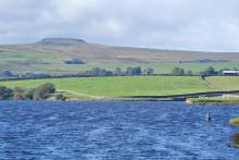
Designated as a Dark Sky Discovery Site, Hury Reservoir has been recognised for the quality of its night time skies. This is a great place for professional and amateur astronomers to stargaze in the North Pennines AONB. Access to Hury Reservoir is only available for stargazing during organised events (see www.northpennines.org.uk). Hury is also a renowned fly fishery.
Location:
Located in Baldersdale, the reservoir can be reached from either Romaldkirk or Cotherstone on the B6277 Barnard Castle to Middleton-in-Teesdale road.
Area:
Access:
Recreation opportunities:
Link:
Killhope Lead Mining Museum

A visit to Killhope, the award winning North of England Lead Mining Museum, is a unique and unforgettable experience. Killhope is a fully restored nineteenth century Victorian lead mine, where you can experience for yourself the life and work of the lead mining families of the Pennine dales. Our enthusiastic and knowledgeable staff are here to help you get the most from your visit; they are what make Killhope a multi award wining venue. Killhope is famous for its huge working waterwheel, but there is much more to Killhope. You can experience the mineshop where miners lived. You can work as a 'washerboy' looking for minerals and galena (which is the lead ore). You can see the working machinery (which Fred Dibnah admired so much) in the 'jigger house'. But above all, Killhope's award-winning mine tour is unique. From the moment you put on your hard hats, cap-lamps and wellingtons, your visit becomes an unforgettable adventure! Killhope holds the largest collection of Spar Boxes which sits alongside Magnificent Minerals and the Pennine Jewels. Two permanent commissions, Letters of Lead and Language of Lead, part of museumaker, a prestigious national project. We also have an array of art works and installations which adorn our visitor centre and site. You can stroll round Killhope's woodland paths (maybe with a nature backpack). You will see some wildlife and red squirrels. Take a break in Killhope Cafe and sample our wonderful home made soups, pasties and cakes. Our gift shop stocks a wide range of books, maps, keepsakes and souvenirs. Killhope - a great day out in the country for all the family!
Location:
Near Cowshill, Upper Weardale, Co. Durham, DL13 1AR.
Terrain:
Steep sections
Area:
Access:
Facilities nearby
Recreation opportunities:
Interests:
Kingsway Adventure Centre
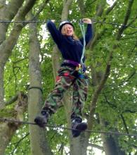
A family run multi-activity centre based in Middleton in Teesdale. For GROUP BOOKINGS ONLY. Minimum group size - 8 people.
Location:
Alston Road, Middleton-in-Teesdale, Co. Durham, DL12 0UU.
Area:
Access:
Facilities nearby
Recreation opportunities:
Low Barns Nature Reserve

Low Barns is a valuable wetland reserve and one of County Durham’s most important wildlife sites, located adjacent to the River Wear. The reserve has become important for wildlife due to the wide range of habitats including wet woodland, grassland, open water and river side, which are home to many different types of birds, mammals, plants and insects. However, Low Barns has not always been a haven for local wildlife. Originally farmland, the site underwent sand and gravel extraction until 1964 when the area was given to Durham Wildlife Trust and restored as a nature reserve. In 2003 a redundant sewage treatment works on the site was replaced with a new reedbed habitat and a boardwalk which enabled public access with minimal disturbance to wildlife. The site’s flat terrain and large accessible bird hides make it an ideal place to visit for everyone. The Visitor Centre has a coffee shop that sells light refreshments, books, gifts, locally made bird boxes and a full range of bird food and feeders from the award winning Vine House Farms. The centre and bird hides provide a wealth of information on how Low Barns was created and the wildlife it supports. Screens in the centre show images from the bird feeding station and bird boxes around the site, and there is a display of wildlife photography provided by the Low Barns Photography Group.
Location:
Durham Wildlife Trust, Low Barns Nature Reserve, Witton-le-Wear, Bishop Auckland, County Durham DL14 0AG.
Terrain:
Off road sections
Area:
Access:
Facilities nearby
Recreation opportunities:
Interests:
Link:
Parkhead Station Dark Sky Discovery Site
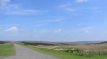
Parkhead station was one of the first five Dark Sky Discovery Sites in the North Pennines AONB to be designated. It has been recognised as a great place for amateur and professional astronomers to stargaze. With wide open views of the horizon and a location away from towns and cities, the skies are incredibly dark. Under a clear night sky, the major constellations can be seen and the Milky Way is also visible to the naked eye. The café is a converted railway station with a rich industrial history - www.parkheadstation.co.uk. Now it is a feature along a traffic free section of the Waskerley Way, just off the C2C Cycle Route which means astronomers are not going to be disturbed or interrupted by the glare of headlights from passing vehicles. During organised stargazing events, the café offers warmth and sustenance and a place to discuss recent astronomical news and sightings.
Location:
Located on the B6278, 3 miles north of Stanhope, 10 miles from Consett.
Area:
Access:
Facilities nearby
Recreation opportunities:
Interests:
Link:
Pow Hill Country Park Dark Sky Discovery Site

Pow Hill is a country park owned by Durham County Council and was one of the first five Dark Sky Discovery Sites to be designated in the North Pennines. Recognised for the quality of its dark night skies, set away from the nearby small settlements of Blanchland and Edmundbyers, this is a brilliant spot for astronomers to stargaze. Its position on the edge of Derwent Reservoir offers a large, uninterrupted view of the northern sky. Under a clear winter nights sky, the main stellar constellations can be seen and on good nights, the Milky Way can also be seen with the naked eye. Good quality surface in the car park and an easy access trail route (on the shore of the reservoir) offers the opportunities for disabled people to stargaze.
Location:
Located off the B6306 Blanchland road on the south shore of Derwent Reservoir - 1 mile north of Edmundbyers, signposted from the road.
Access:
Recreation opportunities:
Interests:
Link:
Download:
RSPB Geltsdale Dark Sky Discovery Site - Clesketts Car Park
Designated as a Dark Sky Discovery Site, Clesketts Car Park has been recognised for the stunning quality of its night skies. This is a great place for professional and amateur astronomers to stargaze in the North Pennines AONB. RSPB Geltsdale is also home to black grouse, birds of prey and breeding wading birds and is great for walking. Stagsike Cottages are approximately a 40 minute walk from the parking area at Clesketts and provide an information point and toilets. Trails are open at all times and the information point is open between 9am and 5pm. Dogs are welcome but they should be kept on a lead as the reserve is a working farm. A bus services the village of Hallbankgate, which is approximately a mile away. More information - www.rspb.org.uk
Location:
From the A69 near Brampton, take the A689 to Hallbankgate and Alston. At Hallbankgate, take the minor road that runs in front of the Belted Will pub; follow this minor road to the reserve car park at end at Clesketts.
Access:
Recreation opportunities:
Link:
RSPB Geltsdale Walking Trails
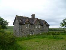
Set in the beautiful North Pennines AONB, Geltsdale is home to black grouse, birds of prey and breeding wading birds and is ideal for walking. There are 4 way marked trails leading from the car park of Howgill. The Stagsike trail will take 1-2 hours to walk and the other trails a little longer. Stagsike Cottages are approximately a 40 minute walk from the parking area and provide an information point and toilets. Many of the trails are on existing tracks but boots are essential for much of the year and waterproofs are recommended. There is no general vehicle access to Stagsike Cottages but disabled access can be pre-arranged by phoning the reserve (01697 746717). Trails are open at all times and the information point is open between 9am and 5pm. Dogs are welcome but they should be kept on a lead as the reserve is a working farm. A bus services the village of Hallbankgate, which is approximately a mile away.
Location:
Starting from Clesketts car park (NY588584), near Hallbankgate.
Terrain:
Boggy ground, Off road sections, On road sections
Access:
Facilities nearby
Recreation opportunities:
Interests:
Link:
Download:
Selset Reservoir Dark Sky Discovery Site
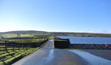
Designated as a Dark Sky Discovery Site, Selset Reservoir has been recognised for the outstanding quality of its dark skies. This is a great place for astronomers to stargaze in the North Pennines AONB. Access to Selset Reservoir is only available for stargazing during organised events (see www.northpennines.org.uk). Selset is also one of best wild brown trout fisheries in the country.
Location:
About 4 miles west of Middleton-in-Teesdale, along the B6276. The reservoir is signposted from the road.
Area:
Access:
Recreation opportunities:
Interests:
Link:
Tan Hill Inn Dark Sky Discovery Site
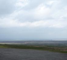
Tan Hill Inn was one of the first five Dark Sky Discovery Sites to be designated in the North Pennines AONB. It's famous for being the highest pub in Britain (at 528m above sea level). The Inn is found on the border between the North Pennines (to the north) and the Yorkshire Dales (to the south) - well away from any light pollution. The designation is official recognition that there are high quality dark night skies here with opportunities for astronomers to stargaze. The open moorland landscape provides fantastic horizon-wide views of the skies so that nearly all features in the northern hemisphere can be seen. In clear skies, all of the major constellations, including Orion, can be seen, and the Milky Way is visible to the naked eye. Tan Hill Inn also offers some warmth and a place to discuss the latest astronomical news and sightings following an evening’s stargazing - www.tanhillinn.co.uk
Location:
On the border between the North Pennines and the Yorkshire Dales border. It's signposted as ‘Tan Hill Inn’ off to the south of the A66 Bowes to Brough road. The nearest postcode is DL11 6ED.
Area:
Access:
Recreation opportunities:
Interests:
Link:
The Bowes Museum

This magnificent museum has undergone a major transformation, creating a stunning 21st century visitor attraction in beautiful grounds. It contains a wonderful collection of fine and decorative arts housed in an array of stunning new galleries. The silver swan automaton is a must see! Exhibitions, guided tours, family activities, fine dining and shopping add up to a wonderful day out.
Location:
Barnard Castle, Co. Durham, DL12 8NP.
Area:
Access:
Facilities nearby
Recreation opportunities:
Link:
The Harehope Quarry Project
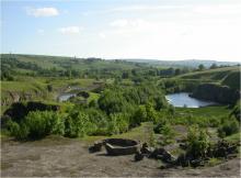
The Harehope Quarry Project promotes a more sustainable way of living and is a Gold Award holder in the Green Tourism Business Scheme (GTBS). Within a former limestone quarry, the project has developed a fish farm and smallholding, a nature reserve with public access and an eco-classroom built entirely by volunteers. The project has a community events programme and delivers environmental education, field studies and education for sustainable development. The eco-classroom can also be booked for meetings, green birthday parties and other events. In addition there walks ranging from 1km to 4km using permissive paths and Rights of Way around the quarry. Story walk leaflets are available as well as information about the Harehope Quarry Project. Note on site parking is limited, however the quarry is a short walk from Frosterley where additional parking is available.
Location:
Frosterley, Bishop Auckland, Co. Durham, DL13 2SG.
Terrain:
Off road sections, On road sections, Steep sections
Area:
Access:
Recreation opportunities:
Interests:
Link:
Waskerley Way Railway Path
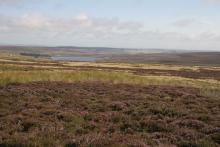
The Waskerley Way is a 16km route running from Parkhead Station above Stanhope in Weardale to Lydgetts Junction, Consett (where is joins with the Lanchester Valley Railway Path, the Derwent Walk Railway Path and the Consett to Sunderland cycle route). It's a beautiful route passing through a varied landscape; from urban fringe through to upland sheep farms and then on to glorious heather moorland. It's suitable for walkers, cyclists, horse riders and wheelchair users. Hownsgill Viaduct towers 46m above the tree canopy of Knitsley and High House Woods near Lydgetts Junction. This is one of the most impressive railway structures in North East England. From further up the Railway Path there are stunning views across Smiddy Shaw, Waskerley and Hisehope Reservoirs.
Location:
The routes runs from Park Head Station, above Stanhope, Weardale (NZ002431 / DL13 2ES) to Lydgetts Junction, Consett (NZ098492 / DH8 9AA).
Distance:
16 km
Terrain:
On road sections
Area:
Access:
Facilities nearby
Recreation opportunities:
Interests:
Link:
Download:
Weardale Museum
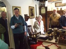
“Outstanding Volunteer Run Museum” – but don’t take our word for it, this is the verdict of Renaissance North East and the Arts Council for England who have also awarded the museum full accreditation. This small folk museum is packed with fascinating stories from the past including a hands on lead-miner’s kitchen and The Weardale Tapestry, a beautiful 16 foot free-style embroidery depicting Weardale’s history. The Museum houses a truly amazing genealogy resource which can print out family trees for those with Weardale ancestry. Visit also the historic and beautiful High House Chapel, the oldest Methodist Chapel to have held continuous weekly services since it was built in 1760, and one of John Wesley’s favourite chapels. Open 2-5pm, Wed-Sunday, May 1st - October 31st and every afternoon in August. Also Easter and bank holidays.
Location:
Ireshopeburn, Co. Durham, DL13 1HD.
Area:
Access:
Facilities nearby
Recreation opportunities:
Interests:
Link:
Weardale Railway
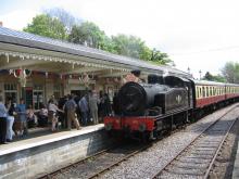
The Weardale Railway runs from Stanhope to Bishop Auckland and stations in between. The railway runs a heritage timetable and has a number of special events through the year, including steam services. There is a ticket office, café and shop at Stanhope Station.
Location:
Stanhope
Area:
Access:
Facilities nearby
Recreation opportunities:
Interests:
Link:
Widdybank Fell Nature Trail: Moor House-Upper Teesdale NNR
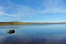
This walk takes you over Widdybank Fell, along the track to Cow Green dam and Cauldron Snout waterfall. The walk follows a tarmac track with 1 large kissing gate and 3 steep sections. Suitable for pushchairs and wheelchairs with strong pushers! However for the last 100m section, to view Cauldron Snout waterfall, the track is rocky and uneven. On the backbone of England, around the headwaters of the River Tees, 8,800 hectares of upland country forms the Moor House–Upper Teesdale National Nature Reserve (NNR). The reserve encompasses an almost complete range of upland habitats typical of the North Pennines, from lower lying hay meadows, rough grazing and juniper woods to limestone grassland, blanket bogs and the summit heaths of the high fells. Nowhere else in Britain is there such a diversity of rare habitats in one location. The remote and dramatic landscape of the reserve can be enjoyed from the Pennine Way National Trail, the Public Rights of Way network and on Open Access land.
Location:
Starting from the Cow Green Reservoir car park (NY811309)
Distance:
5 km
Terrain:
Off road sections, On road sections, Steep sections
Area:
Access:
Recreation opportunities:
Interests:
Wolsingham Family Walk
This 1.5-mile circular walk has been devised by the Wolsingham Wayfarers, to provide a route around Wolsingham that can be enjoyed by all. The walk is entirely on surfaced footpath, upgraded to be accessible for pushchairs and wheelchairs.
Location:
Starts from the recreation ground (off the A689 Stanhope road)
Distance:
2 km
Area:
Access:
Facilities nearby
Recreation opportunities:
Link:
Download:


